|
Central Hall Events (2024)
Yard Sale(s) Sept 28 (Sat, 8am - 1pm) & Sept 29 (Sun, 8am - 12pm) Other event dates TBD |
New Domain name coming when the new site is ready
Some location history has shifted to www.bluehillfalls.me |
The Blue Hill Falls Bridge is Open
Welcome! This site supports the Ladies Public Improvement Society (LPIS) that serves the community through its location at Central Hall on the Blue Hill Neck (So. Blue Hill). The group serves a small community on the mid-coast of Maine that has prospered since its first settlement in 1762. Inspired by the area’s incomparable beauty, people have taken pretty good care of themselves and each other. This includes the use of local resources to craft the homes, schools and churches that dot what is now known as the Falls Bridge Road which connects the towns of Blue Hill and Brooklin.
Many of the first settlers to the Blue Hill area were came from English, Irish and Scottish ancestry. The rocky coast and close access to good fishing and hunting must have appealed to them. There were also trees for building materials. We know that in 1763, John Roundy and Joseph Wood built a mill on what we now call Mill Island, a piece of land nestled between Conary Cove and the Blue Hill Falls. There were no bridges then and early property lots were laid out in 80 acre parcels. Only three (3) of these lots are left intact on the Blue Hill Neck today, extending from Blue Hill Bay to the Salt Pond.
The photos shown include those of Blue Hill Falls (north & west of the Falls Bridge to Bragdon Brook) and South Blue Hill, located on the Blue Hill Neck. The area had two schools and the Blue Hill Falls Post Office in 1881. Both school houses (SH) are noted by arrows on the map below. Neither exist today though the old Blue Hill Falls PO building (now with blue siding) does, and sits back from the road at the corner of Mill Pond Ln and Falls Bridge Rd. The Blue Hill Falls school at the head of Conary Cove and the BHF Post Office can be seen in the slideshow below.
Things do Change.
Do you know who built the "LeVeque" Boathouse on Conary Cove in Blue Hill Falls?
Do you remember when it wasn't there at all, or was painted a color other than Red?
Note some of the changes in the photos below.
Do you know who built the "LeVeque" Boathouse on Conary Cove in Blue Hill Falls?
Do you remember when it wasn't there at all, or was painted a color other than Red?
Note some of the changes in the photos below.
CLICK Photos to view larger!


The NEW Blue Hill Falls Bridge
Photo & Video (Butler Smythe - June '24) VIDEOS |
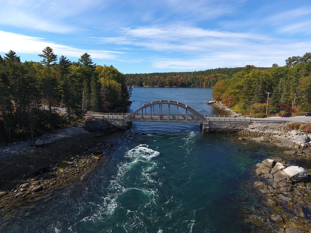
Drone Photo above by Butler Smythe


Photos above by Jim Murray
For the Poem "Bluehill"
| ||||
|
|
|
Notes:
1. Blue Hill Falls Plus video - 7 min long with music... can Fast Forward...
2. Kayaking video - listen for conversation near end & winter hazard....
3. Refresh/reload web page using right hand circular element. YouTube video will return for viewing.
1. Blue Hill Falls Plus video - 7 min long with music... can Fast Forward...
2. Kayaking video - listen for conversation near end & winter hazard....
3. Refresh/reload web page using right hand circular element. YouTube video will return for viewing.